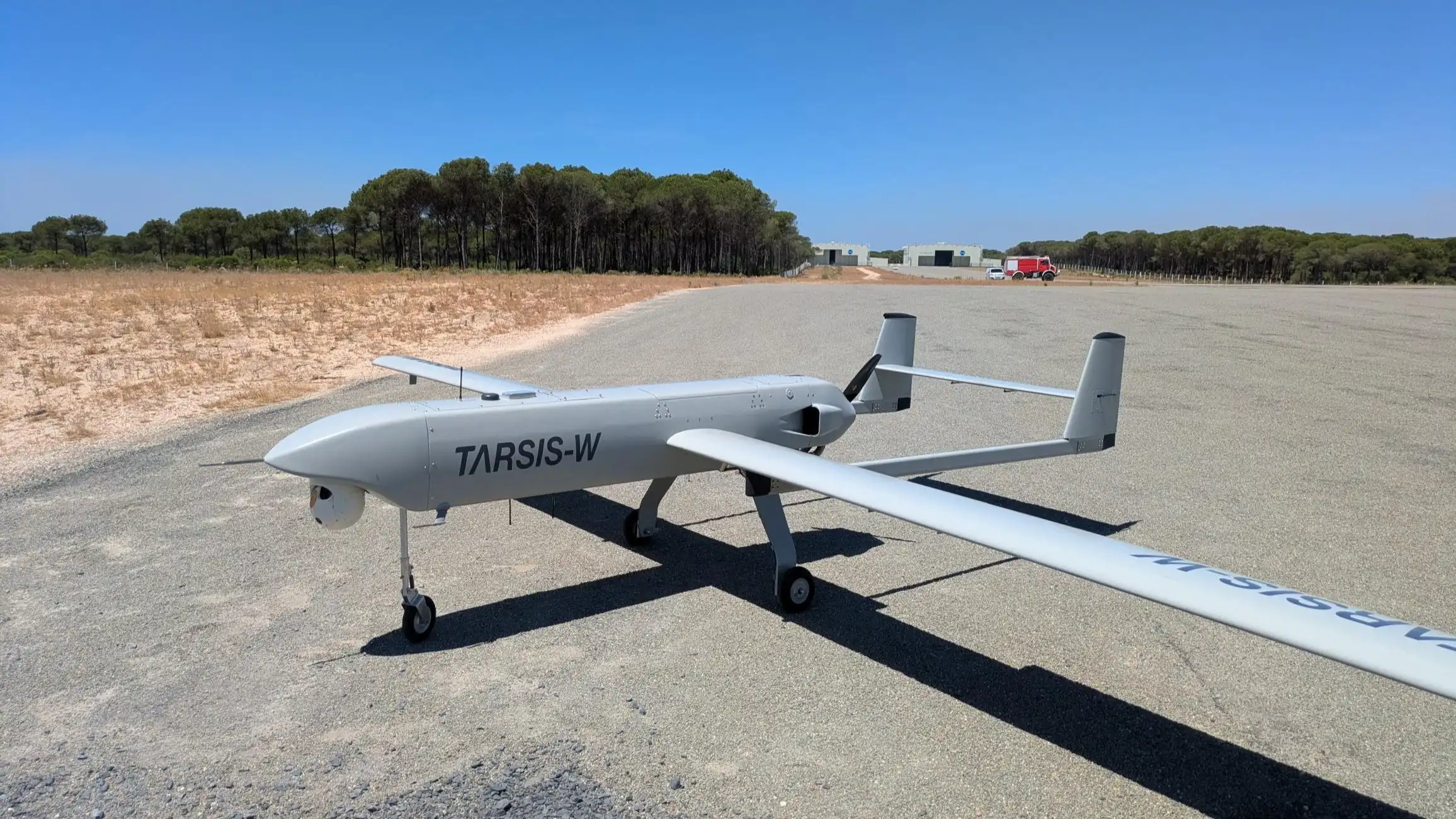
The AIRSENSE navigation system, funded by the European Defence Agency (EDA), kept a tactical drone in Spanish Army service close to its true position over land without satellite signals during trials in Portugal in September, the agency announced on October 16, 2026. Developed by Spanish firms GMV and Indra, the system lost effectiveness over the sea. During the campaign, the fixed-wing aircraft flew more than 100 km from its ground control station and reached 2,100 meters, roughly 6,900 feet.
The flights ran under the Unmanned Aircraft Systems Single European Sky eXperimental Integration (USESXI) project, a €1.2 million, four-year EDA effort running to 2028 that seeks a resilient positioning, navigation and timing (PNT) solution for unmanned aircraft systems (UAS) when Global Navigation Satellite Systems (GNSS) are unavailable, degraded or jammed. GNSS jamming and spoofing have become routine along the front in Ukraine and persistent over the Baltic region. The trials took place at the Robotic Experimentation and Prototyping using Maritime Unmanned Systems (REPMUS) 2026 exercise, held from August 31 to September 25 around Troia, south of Lisbon. Led by the Portuguese Navy, with EDA as co-organizer since 2024, the 2026 edition drew more than 3,700 participants and 300 unmanned systems, according to NATO.
AIRSENSE Navigation Results: Strong Over Land, Weak Over Water
AIRSENSE combines onboard sensors with artificial intelligence to interpret the surrounding environment and hold a position fix without satellite input. EDA said the results show that fusing several navigation sources through advanced algorithms can deliver a reliable position when satellite navigation is unavailable or cannot be trusted. The agency has not detailed the sensor suite beyond its image-based core.
The REPMUS campaign tested imagery capture, data transmission and sensor synchronization, and whether the system could support flights beyond visual and communications line of sight. The key milestone, per EDA, was running the image-based navigation software on board the aircraft in real time, rather than processing the data after the flight or at the ground station. Ground-side processing would tie navigation to the data link, and on a contested front, command and video links are prime electronic warfare targets.
Over land, AIRSENSE stayed close to the aircraft’s true position without satellite signals. Over the sea, performance dropped because the sensor-based software found too few reference features to recognize. EDA said it will concentrate future work on land operations, in line with lessons from current conflicts, and that the maritime shortfall does not affect project priorities. According to GMV, the Troia flight campaign, held September 7 to 11, was the final in-flight validation for the first two phases of the effort, which the company designates AIRSENSE SC2, and covered maritime, coastal and land conditions.
Test Airframe and the GMV-Indra Industrial Base Behind USESXI
EDA described the test aircraft only as a commercially available drone already in service with the Spanish Army. Imagery released with the announcement shows a fixed-wing airframe bearing TARSIS-W markings. The TARSIS family originated at Aertec, whose drone unit, Aertec Defence & Aerial Systems, Indra acquired on July 29, 2025.
Manufacturer data describes the baseline TARSIS 75 as a Class I, all-carbon-fiber design carrying more than 12 kg of payload for up to 12 hours. The heavier TARSIS-W, at a quoted 120 kg takeoff weight, can carry A-Fox semi-active laser-guided micro-missiles with a stated range of 4 km. Aertec lists data-link operational ranges of 70 km or 150 km for its TARSIS systems, so the 100 km REPMUS profile exceeded the shorter option. GMV says the AIRSENSE payload flew on the TARSIS platform, but neither GMV nor EDA has specified the variant or configuration.
Indra now owns the airframe line and co-develops the navigator. GMV brings established military PNT work: its ISNAV navigation and timing unit, designed to position vehicles with or without GNSS, was selected for 240 of the Spanish Army’s 348 Dragón 8×8 wheeled combat vehicles. AIRSENSE carries that assured-PNT expertise into small tactical aircraft.
Analysis: The over-water result defines the system’s envelope as clearly as the land result does. Vision-based navigation needs ground features, which suits the land theater where European GNSS denial is now most acute, from the Ukrainian front to NATO’s eastern flank. That makes EDA’s land-first choice defensible, but it leaves a gap for maritime UAS and long transits over featureless terrain, where complementary PNT layers will still be required. The more consequential result is architectural: real-time onboard processing on an in-service airframe removes the data link as a single point of failure, a principle European tactical drone programs will need regardless of which navigation sensor prevails.
EDA said the next step is to mature AIRSENSE into a complete, standards-compliant system ready for operational use, with a return to REPMUS in 2027 before USESXI concludes in 2028. Key unknowns remain: the agency has disclosed no accuracy figures, has not named the applicable certification standards, and has announced no procurement commitment from Spain or other participating member states.