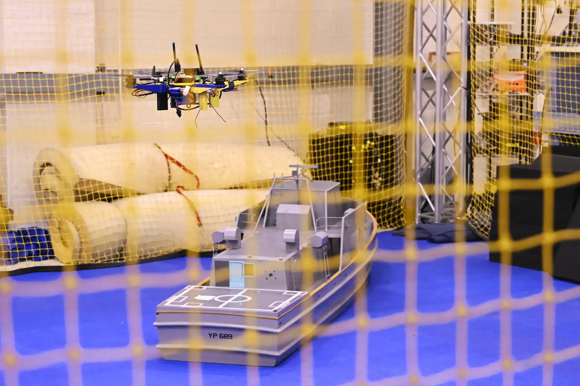
The U.S. Navy has flown a tactical unmanned aircraft through mission tasks and recovered it autonomously aboard a pitching vessel at sea with no GPS and no pilot in the loop, the Naval Air Warfare Center Aircraft Division (NAWCAD) announced on October 14, 2026. The aircraft relied only on its own commercial-standard cameras, motion sensors and onboard electronics, running guidance software developed in-house at Naval Air Station Patuxent River, Maryland.
The Navy has traditionally solved shipboard drone recovery with hardware. When two RQ-8A Fire Scout test aircraft completed the type’s first autonomous shipboard landings aboard USS Nashville (LPD 13) in January 2006, a ship-based UAV Common Automatic Recovery System (UCARS) guided them onto the deck. According to NAWCAD, current recovery architectures still depend on radar systems costing millions of dollars, flight deck recovery gear and ship modifications that can take months to install. In a contested theater where satellite navigation is jammed or unavailable, that dependency becomes a vulnerability.
How NAWCAD Achieved Drone Landing Without GPS at Sea
The capability comes from NAWCAD’s Maritime Autonomous Guidance-Navigation-Control Intelligent Coupled Systems Lab, which paired the aircraft’s existing mission cameras with a guidance, navigation and control (GNC) software stack. During the approach, the drone uses its camera to recognize the ship’s shape and visual cues, steering toward the vessel much as a human pilot flies a visual approach. In the terminal phase, the GNC algorithms predict the deck’s rising and falling motion in real time so the aircraft can time a smooth touchdown.
Deck-motion prediction is the critical element: a vertical-landing aircraft must meet a spot that heaves, pitches and rolls with the sea, and a mistimed arrival risks a hard landing or a rollover. Onboard vision and inertial sensing remove the need for cooperative equipment on the ship.
NAWCAD states the software runs on nearly any unmanned aircraft system (UAS) flight computer and scales from small tactical quadcopters to large, combat-class aircraft. Imagery released with the announcement shows an unmanned system maneuvering over a scale model of a Navy Yard Patrol craft inside an indoor flight test facility at NAWCAD.
Several parameters remain undisclosed. The Navy has not identified the aircraft type, the vessel used at sea, the sea state, the number of recoveries performed or the touchdown accuracy achieved.
Replacing Shipboard Radar With Software: Path to STUAS, CCA and EVADE
“In a high-end maritime conflict, GPS is the first operational link an adversary attempts to sever,” said Peter Arslanian, a NAWCAD aerospace engineer. “By developing a modular adaptable system and putting it directly onto a UAS, we expand where and how the fleet can deploy unmanned systems with a simple software upgrade rather than expensive modifications to space-constrained ships.”
Rear Adm. Todd Evans, NAWCAD’s commander, framed the result in operational terms: “In contested areas where satellites and communications are jammed, autonomy gives significant advantage to our sailors.” He added that such breakthroughs help the Navy “scale unmanned capability fast and affordably across a distributed fleet.”
NAWCAD says the software is now ready for operational testing on fleet platforms. The warfare center is working to transition it into three acquisition channels: the Navy’s Small Tactical Unmanned Aircraft Systems (STUAS) program office, the Collaborative Combat Aircraft (CCA) program and the Defense Advanced Research Projects Agency’s Early VTOL Aircraft Demonstration (EVADE). EVADE, announced by DARPA in June 2025 to accelerate its ANCILLARY program, targets vertical takeoff and landing drones that can operate from ships without additional launch or recovery infrastructure. The Naval Innovative Science and Engineering Program and the Office of Naval Research funded the NAWCAD work.
Analysis: The demonstration moves the recovery burden from the ship to the aircraft. If recovery requires only software, any vessel with a clear deck area becomes a potential drone host without a shipyard availability, a meaningful advantage for a fleet pursuing Distributed Maritime Operations with limited dock time. Dropping a shipboard recovery radar also removes one emitter a ship must radiate to bring an aircraft home, a relevant consideration given NAWCAD’s own assessment that GPS is the first link an adversary will try to sever in a maritime conflict. The open question is environmental robustness: vision-based recovery that works on a test range must also hold in fog, darkness, spray and high sea states before program offices commit to it.
The next milestones are operational testing aboard fleet platforms and scaling to larger aircraft, including tactical resupply drones. NAWCAD has not published a test schedule, a target program of record or a fielding date. Which of STUAS, CCA or EVADE adopts the software first, and the sea state at which the Navy certifies it, will determine how quickly GPS-independent recovery moves from demonstration to deck.